Welcome to the world of extreme precision. The Ultra-Long Baseline Facility / Large-Length Calibration Standard System is a marvel of modern metrology, consisting of three core components: the Long Guideway Standard System, the Laser Scanner Calibration System, and the Vertical Length Standard System.
Let's dive into the fascinating technical blueprints that make this giant scientific apparatus work.
1. The Long Guideway Standard System
At the heart of the facility lies the long guideway system—a masterpiece of granite component and motion control. It integrates a support structure, a sliding air-bearing table, a meticulous network of environmental sensors (monitoring air/material temperature, humidity, and pressure), dual-frequency laser interferometers, an image acquisition system, ruler platforms, mechanical mounts, an adjustment table for instruments under test, and a powerful data processing system.

Key Technical Specifications:
(1) Static length measurement error: ±(0.1μm + 0.1×10⁻⁶L); ★ (Customizable)
(2) X-axis positioning accuracy (∆d): |∆d| ≤ 2μm; ★ (Customizable)
(3) Maximum movement speed: 5m/s; ★ (Customizable)
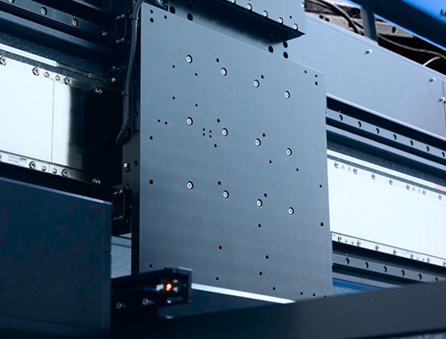
(4) The Foundation: The guideway is crafted from premium marble/granite. Its working surfaces are flawlessly finished—free from scratches, cracks, delamination, or rust that could compromise the air-bearing performance. The inner side of the rail features a precision-machined slot for the linear motor. The entire 56-meter system is seamlessly assembled from 14 individual 4-meter segments, providing an effective travel stroke of no less than 54 meters. Its cross-sectional dimensions are exceptionally robust, measuring at least 600mm × 400mm.
(5) X-Axis Guideway Straightness: ★
In the horizontal plane: ≤0.003mm/m; 0.015mm/4000mm; 0.06mm/20m; 0.3mm/50m (Lengths are customizable).
On the lateral guide surface: ≤0.003mm/m; 0.02mm/4000mm; 0.07mm/20m; 0.35mm/50m (Lengths are customizable).
(6) Support System: The guideway relies on primary air-bearing support blocks and an auxiliary support system. Because even the solid earth moves, the support system is highly adjustable. If minor foundation settlement occurs, the rails can be realigned with an adjustment range of at least ±15mm. ★
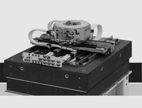
(7) The Sliding Platform: The worktable utilizes an air-suction design with a solid granite body. It features a driven suction slider and an electromagnetic shut-off valve for automatic pneumatic locking. The table moves like a ghost—guaranteed never to bind, lock up,or scratch the guideway. It supports both manual and automated operation, comes equipped with an automatic dust-clearance function, and features threaded holes for mounting optical accessories.Payload capacity: ≥ 30kg. (Customizable)
(8) Comprehensive Motion Straightness (Air-bearing platform on the guideway): ★
In the horizontal plane: ≤0.01mm/m; 0.02mm/4000mm; 0.08mm/20m; 0.32mm/50m (Lengths are customizable).
On the lateral guide surface: ≤0.03mm/m; 0.08mm/4000mm; 0.09mm/20m; 0.40mm/50m (Lengths are customizable).
The Nervous System: Environmental & Optical Measurement
(9) To achieve sub-micron accuracy over massive distances, the environment must be strictly controlled. The system deploys 26 air temperature sensors, 4 material temperature sensors, 2 humidity sensors, and 1 air pressure sensor. The software digests this data in real-time to mathematically compensate for environmental shifts. All sensor mounts are custom-designed to be fully adjustable, ensuring absolute stability.
(10) Temperature sensors: Range: (20±5)℃; Maximum Permissible Error (MPE): ±0.05℃; ★
(11) Relative humidity sensors: Range: (10~90)%RH; MPE: ±3%RH; ★
(12) Air pressure sensor: Range: (700~1100)hPa; MPE: ±20Pa; ★
(13) Laser Interferometry: The system utilizes three independent, long-range dual-frequency laser interferometers to form a "spatial triangle" measurement system. This ingenious design automatically corrects for Abbe errors across three optical paths. Mountings strictly adhere to manufacturer standards. One set serves as a verification standard (with reserved mounting space). The software simultaneously reads the three laser modules and the real-time environmental data to deliver flawless, Abbe-error-compensated length measurements across varying distances.
(14) Laser interferometer upper measurement limit: ≥ 60m; (Customizable)
(15) Laser type: Helium-Neon Zeeman dual-frequency laser;
(16) Laser wavelength: 632.9889926nm ~ 632.9936206nm;
(17) Frequency stability: 2×10⁻⁸ (over a 3-hour period); ★
(18) Resolution: 1nm;
(19) Sampling frequency: 100kHz;
(20) Vision & Image Acquisition: Equipped with specialized mounts for standard steel tape measures (pulleys, weights) and Invar leveling staves. The cameras send real-time feeds to the main computer to automatically recognize and calibrate scale lines. The camera lenses are fully adjustable (up/down, near/far from the rail) to ensure crisp imaging. Line-sighting repeatability: ≤ 2μm; ★
Motion Control & Mechanics
(21) Motion Control: The system is fully automated. By linking the linear motors, sensors, and laser interferometers, it operates as a unified closed-loop ecosystem. The air-bearing table relies on a two-stage linear motor drive scheme, delivering both blazing-fast travel and pinpoint static positioning. The platform is designed to be lightweight yet rugged, maximizing the operational workspace for mounting various instruments. Cable management is handled by a high-speed rolling cable drag chain system.
(22) Includes all necessary mechanical accessories: guideway supports, structural mounts, lifting tools, laser alignment fixtures, mirror brackets, sensor mounts, and installation jigs.
(23) Roller platform accessories: Designed to hold tape scales with a catenary support span of 250mm. Includes adjustable mounts for barcode staffs and Invar leveling staves.
(24) It features three highly adjustable workstations for testing handheld laser distance meters (allowing pitch, yaw, roll, elevation, and horizontal rotation adjustments), paired with standard white/gray reflective plates. These also assist in adjusting the height of the interferometers being tested.
(25) Data Processing System: Industrial PC.
2. Laser Scanner Calibration System
To calibrate cutting-edge 3D laser scanners, the facility provides an uncompromising arsenal of reference artifacts:
(1) Standard spheres:
One 200mm sphere (Matte finish, roundness ≤ 0.1mm);
Eleven 125mm spheres (Matte finish, roundness ≤ 0.1mm);
(2) Spatial point measurement uncertainty: ≤ 0.015mm + 6×10⁻⁶L; ★
(3) Standard flat plate: Matte ceramic, measuring 450mm × 80mm, with a flatness (RMS) of 3μm;
(4) Standard ball plate: Matte ceramic. Features 18 spheres (9 pairs of varying diameters). Measurement range: 16m ~ 320mm. Sphere roundness and diameter uncertainty U = 0.5μm; Sphere spacing uncertainty U = 1.5μm;
(5) Standard ball bars (one each of 800mm, 1200mm, and 1800mm): Outer diameter 38.1mm, Length uncertainty U = 6μm (k=2);
(6) Ceramic spheres: 4 pieces (Diameter 38.1mm, matte, roundness 2μm,diameter U = 2μm (k=2));
(7) Steel spheres (Matte): 2 pieces (Diameter 38.1mm, roundness 2μm,diameter U = 2μm (k=2));
(8) Steel spheres (Glossy): 2 pieces (Diameter 38.1mm, roundness 2μm,diameter U = 2μm (k=2));
(9) Standard ball sockets: 2 pieces (Diameter 38.1mm);
(10) Granite surface plates (all Grade 00):
2500mm × 1600mm × 300mm
1000mm × 750mm × 150mm
300mm × 200mm × 50mm;
(11) Dedicated fixing plates: Two 500mm × 500mm plates (custom-ground marble base topped with a steel plate featuring an M6 threaded hole grid at 25mm spacing). These are deployed on the 56m guideway and granite plates to securely lock down instruments like measurement arms.

3. Vertical Guideway Standard System
When measurements move into the Z-axis, this system takes over, comprising a vertical guideway, auxiliary tooling, a master control system, and a dedicated sensor suite.
(1) Measurement range: ≥ 2.3m; (Customizable)
(2) Maximum Permissible Error (MPE): ±(0.2μm + 5.0×10⁻⁶L); ★
(3) Measurement system positioning repeatability: 2μm; (Customizable)
(4) Vertical guideway straightness: ≤ 0.020mm/H; (Customizable)
(5) Motion System: It utilizes a magnetic pre-load air bearing system gliding on granite component The motion control positioning accuracy (deviation from target) is better than 2μm. Platform payload: ≥ 20kg; ★ (Customizable)
(6) Environmental system: 4 air temp sensors, 2 material temp sensors, 1 pressure sensor (shares the humidity sensor with the long guideway), plus all necessary brackets and cabling.
4. Large-Length Standard System Software Features

Hardware is only as good as the software commanding it. The system's digital brain offers the following capabilities:
(1) Laser Data Parsing: Continuously reads and precisely corrects interferometer data based on the exact laser wavelength.
(2) Spatial Triangle Abbe Error Elimination: Magically eliminates Abbe errors for multiple instruments simultaneously at any point in space, utilizing the three-laser geometry.
(3) Real-Time Environmental Compensation: Automatically harvests temperature, pressure, and humidity data to constantly calculate the air refractive index, adjusting length measurements on the fly.
(4) High-Precision Vision Measurement: By fusing laser data with camera feeds, the software automatically detects line edges to measure intervals on physical scales with staggering accuracy.
(5) Intuitive Human-Machine Interface (HMI): Simply type in a target distance, and the software smoothly drives the linear motors to the exact destination, displaying real-time travel stats.
(6) Emergency Braking: Ensures operator and equipment safety by halting motion instantly when required.
(7) Open Protocols & Support: Communication protocols (RS232/RS485) are completely open and free to the buyer, backed by complimentary technical support for system integration.
(8) Remote Operation: Fully supports remote control and remote data transmission over a network.
(9) Universal Calibration Templates: Comes pre-loaded with testing templates for an impressive array of instruments: laser trackers, laser interferometers, third-class metal line scales, standard steel tapes, long-range linear displacement sensors, laser scanners, leveling staves, photogrammetry scales, laser distance meters, and industrial total stations.
(10) Custom Development: Allows users to build their own bespoke calibration templates using custom parameters.
(11) Data Management: Features robust tools for recording data, querying historical results, and exporting directly to Excel or TXT formats for easy analysis.
Related product links are as follows: